
- The National Weather Service predicts "equal chances" for Utah's winter precipitation and temperatures.
- Southern Utah may see above-normal precipitation due to strong El Niño patterns.
- High soil moisture levels and potential snowpack could benefit Utah's water supply.
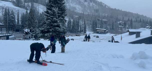
SALT LAKE CITY — Winter is coming, as evidenced by the snow that reached the Wasatch Front valleys for the first time this season on Tuesday.
However, it's still too early to tell if this week's storms are a harbinger of what's to come, even though the meteorological season begins in less than two weeks.
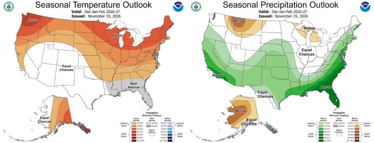
The National Weather Service's Climate Prediction Center on Thursday released its final three-month outlook for the meteorological winter months of December, January and February.
It lists most of Utah as having "equal chances" when it comes to temperatures and precipitation, with southern Utah having a slightly higher probability for above-normal precipitation. Equal chances mean there's no clear signal for the upcoming meteorological season, either temperature- or precipitation-wise.
That's par for the course during any standard El Niño or La Niña winter, as Utah is caught between both patterns — although both patterns have also produced the state's best snowpack totals on record.
This winter is expected to be influenced by one of the strongest El Niño setups on record.
Yet, what the agency's outlook shows for other states offers signs of hope for snow recreation enthusiasts and water managers across the Beehive State, said KSL meteorologist Devan Masciulli.
A 'good outlook'
Masciulli was immediately drawn to where above-normal and below-normal precipitation is most likely over the course of the season. Higher precipitation odds are located along the Pacific Coast, from Oregon to Mexico and the Southwest, while the worst odds are located by Alaska, Canada and Montana.
It indicates that the models are suggesting there are two potential prominent storm tracks most likely over the season, she explained.
A high-pressure ridge will likely form over Alaska or Canada in both scenarios.
Precipitation that would come from the Pacific Northwest could hit the high-pressure ridge, pushing it south down toward California before it moves east — similar to how this week's storms have passed through Utah. It's also possible that storms could enter through California, especially toward its southern end, and move east from there.
Utah is often in the middle of either scenario.
"We're in a really good middle position, where the probabilities all around us are high for above-normal precipitation. And while we're in an equal spot, I think it's more positive to be in the equal chances than the low chances," Masciulli said. "I think this is a good outlook for hoping for more unsettled weather."
Not knowing how strong each storm will be this far out is likely why places like Utah are listed in "equal chances."
Another positive sign is that other long-range models, looking as far out late winter toward early spring, show most of Utah having a greater chance for above-normal precipitation, with even higher odds in southern Utah.
What about temperatures?
The two scenarios can offer drastically different storm types, though, which could explain the temperature uncertainty.
Cold air often comes with the first scenario, but those can be drier; the second option often brings wet and warmer storms. Utah's temperature is likely "equal chances" because it can go either way, or there's a mix of both.
If there's a positive sign, this is the center's first seasonal outlook that doesn't list the majority of Utah as having a greater chance for above-normal temperatures in three years. Utah's warmest year on record was 2025, and 2026 is still on pace to be even warmer.
Last winter proved how consequential temperatures can be.
Utah experienced its warmest winter on record last year, which heavily factored into why it produced its worst snowpack on record. That, in turn, led to serious drought ramifications, including reduced water allocations and one of its worst fire seasons on record.
This outlook is "refreshing" because it likely also indicates that models don't believe high-pressure systems will primarily set up over the state, Masciulli said. That's been a factor in the state's record-warm streaks.
"I'd rather see (equal chances) than any kind of odds favored toward above-normal temperatures," she said.
Capitalizing on soil moisture
All eyes are still on Utah's mountain soil moisture levels, which remain the highest on record for fall since the Utah Natural Resources Conservation Service established its network over 20 years ago.
Those levels have surged, with Utah receiving precipitation ahead of winter at a pace not seen in over a century. Utah's average precipitation collection between July and October is the most since at least 1895, and the run hasn't let up this month.
Approximately 95% of the state's water supply comes from snowpack, and higher soil moisture levels typically equate to more efficient snowpack runoff during the spring.
Thus, Utah's reservoir system, sitting at 51% capacity, and the Great Salt Lake will likely benefit from a strong snowpack.
How much it will benefit likely depends on how the winter goes, Jordan Clayton, a hydrologist for the Natural Resources Conservation Service, told KSL earlier this month.
"The snow has to come," he said. "It can't just be the moist soils."