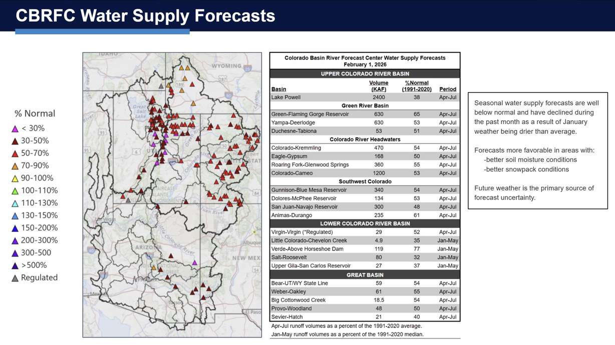
- Lake Powell's water inflow is on track to be 38% this year after Feb. 1, lower than Jan. 1 expectations.
- Utah's snowpack is at record-low levels, impacting water supply forecasts statewide.
- Upcoming storms may improve conditions but uncertainty remains about snow levels.
SALT LAKE CITY — Lake Powell levels were already bleak, and January didn't provide any favors.
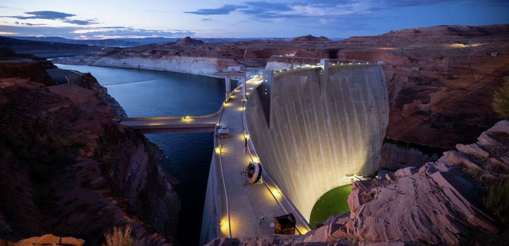
The nation's second-largest reservoir, located by the Utah-Arizona border, is now projected to receive 2.4 million acre-feet of water this spring, a 34% decline from what was expected after Jan. 1 conditions, experts for the National Weather Service's Colorado Basin River Forecast Center said in an update on Friday.
Should that outlook come to fruition, it would be 38% below its median, and one of its lowest springtime bumps ever. It's based on warm, dry conditions across Utah and the Intermountain West in January, which exacerbated the region's suboptimal snowpack conditions so far this winter, said Brenda Alcorn, a forecaster for the Salt Lake City-based center.
"Snowpack conditions are poor across almost the entire area," she said.
Many snowpack sites along the Upper Basin recorded record or near-record-low snowpack collections in January. Snowpack accounts for about 95% of Utah's water supply and the vast majority of the Colorado River's supply.
The low levels are tied to mild temperatures and fewer storms throughout the month, after record-high temperatures in November and December made it difficult to collect low- and mid-level snowpack.
Utah's statewide snowpack slipped into record-low status at the start of this month, and there's now a 30% probability that this year will be the state's worst snowpack since at least 1980, the Natural Resources Conservation Service also reported on Friday.
Colorado snowpack levels are also on pace to break a record low, and they are below normal across the rest of the Colorado River Basin states, according to the agency's data.
Friday's outlook comes as Lake Powell levels have already slipped to 26% of capacity, close to the emergency-low levels it experienced a few years ago. However, other bodies of water in the river basin — and in Utah — are also facing some of their worst runoff conditions this spring, barring a change in the forecast.
The Green River has been the Colorado River basin's "lone bright spot" this year because of better snowpack conditions during the first three months of January, Alcorn said. Yet Flaming Gorge is still facing the possibility of runoff reaching 65% of normal.
Spring runoffs in the Bear, Weber and Provo rivers, as well as Big Cottonwood Creek, may end up 50% to 55% of their median averages, which would be a blow to water users across Utah's northern half, and to the Great Salt Lake. The lake may gain only another half-foot under the most likely scenario at this point, according to the Conservation Service's latest update.
The Virgin and Sevier rivers within Utah's southern half may end up with levels that are 40% to 52% of normal, the Colorado Basin River Forecast Center added. The Colorado River's headwaters are also on track to be 50% or 55% of normal this year.
Utah water officials previously warned that the state may have to dip deeper into its reservoir system, sometimes referred to as the state's water "savings account," this year. Utah's reservoir system, minus Lake Powell and Flaming Gorge — remains 66% full, 4 percentage points above the median average for early February.
Smaller reservoirs that typically refill with snowpack every year may not refill much this year, though.
Can Utah turn it around?
It's not all grim news, though, says Jordan Clayton, a hydrologist for the Conservation Service. He notes that soil moisture levels, while dropping, remain above normal for early February, which bodes well for spring runoff.
The season isn't over either, which is the largest caveat to the data. Future weather is the primary reason there's still a decent-sized margin of error in the outlook. That changes with each report as spring nears.
"The above-normal soil moisture levels in Utah's mountains may promote efficient snowmelt runoff this spring if we can get some snow up there," Clayton wrote in the agency's update.
But Utah still needs "numerous significant storms" to get back on track, he adds. That also requires enough storms that are cold enough to produce low- and mid-level snowpack.
That starts with next week. A cold front system is forecast to cross into Utah Monday afternoon to break up the weeks of stagnant weather, said KSL meteorologist Devan Masciulli. It's expected to stall over the region, allowing a low-pressure system to bring more rain and snow on Tuesday and Wednesday.
It's too early to know what the snow line will be from the system or how much moisture the storms will deliver, but long-range forecasts indicate more moisture and near- to below-normal temperatures remaining in Utah through the middle of February. There are some signs this could continue into late February and early March, too, but those outlooks are even less certain.
"It's so tricky right now because the storms are so spring-like. That's why it's so right now to look so far in advance to try to predict a snow level," she said. "There's just so much uncertainty."