
Estimated read time: 3-4 minutes
- Storms in Utah ended moderate drought in some areas for the first time in March.
- 8.7% of Utah is now 'abnormally dry' with reduced severe drought levels.
- Recent storms caused flooding, but improved soil moisture for snowpack runoff potential.
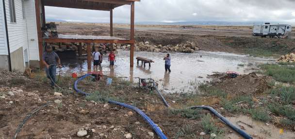
SALT LAKE CITY — Storms that moved through Utah this week resulted in serious flooding in southern Utah, even leading to a disaster emergency in Hurricane.
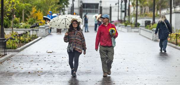
However, the wet weather has also pulled some parts of Utah out of moderate drought for the first time in seven months, while also chipping away at the severity elsewhere in the state.
About 8.7% of the state — mostly the Uinta Mountains and Uinta Basin, but also parts of southeast Utah — is now considered "abnormally dry," a level between drought and normal conditions, the U.S. Drought Monitor reported Thursday.
It's the first time any part of the state has not been in at least moderate drought since its March 31 report. Meanwhile, the percentage of Utah in severe or worse drought dropped from 71.4% last week to 61.9% this week.
Only 13.6% of the state remains in extreme drought, down from 22.5% last week and 33% a month ago. The worst conditions are found across portions of central and northwest Utah.
Heavy rainfall and mountain snow "helped replenish soil moisture and ease short-term deficits" in Utah and nine other states over the past week, wrote Lindsay Johnson, a climatologist for the High Plains Regional Climate Center at the University of Nebraska-Lincoln, in an adjoining report.
It's based on conditions collected on Tuesday, before additional moisture came through this week. The latest multi-day storm has already brought as much as 6.4 inches to the mountains west of Monticello, while many other sites in central and southern Utah received 1-2 inches or more.
Ben Lomond Mountain received 3.6 inches, the highest total across Utah's northern half.
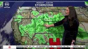
Some additional showers are likely across southern Utah this weekend as a low-pressure system that broke up and moved south of the state moves across southeast Utah before it clears out, said KSL meteorologist Devan Masciulli.
Next week's drought report will better show the impact of this week's moisture, which also elevated mountain soil moisture levels to the highest levels ever seen during meteorological fall on record.
A double-edged sword
Utah's average saturation of 71.4% on Friday beat the previous record of 66.9% set in November 2021, per Natural Resources Conservation Service data.
Its data goes back to 2006, a small sample size, but higher fall soil moisture can help produce more efficient snowpack runoff in the spring. Approximately 95% of the state's water supply is tied to snowpack.
Of course, recent storms also caused flooding, with at least 130 residential structures affected in Hurricane.
"It's a double-edged sword," Masciulli said. "You saw how long we've been in drought status of some sort, so it's nice to get these storms and also to get them frequently, but it's not nice when they have such a tropical push to them, and that's why we've had a lot coming at once."
More to come?
Long-range models suggest that stormy weather will continue across the West to close out October and begin November, likely impacting Utah.
Exact totals are unclear at the moment, and it's unclear what regions will receive storms because of movement across the West, Masciulli explained.
This week's storm was a forecasting nightmare because it took a long time to move and split up as it moved east, and that kind of uncertainty is possible with activity across the West.
However, the National Weather Service's Climate Prediction Center also lists southern Utah as having stronger chances for above-normal precipitation throughout November, while the rest is listed as having "equal chances." This means there's no signal whether totals will be above-, below- or near-normal.
It's a sign that wet conditions may continue to chip away at drought, while all eyes are on what type of snowpack Utah can collect this winter.