'%3e%3cpath%20d='M34.1406%205.85938C30.3906%202.10547%2025.3047%200%2020%200C14.6953%200%209.60938%202.10547%205.85938%205.85938C2.10938%209.61328%200%2014.6953%200%2020C0%2025.3047%202.10547%2030.3906%205.85938%2034.1406C9.61328%2037.8906%2014.6953%2040%2020%2040C25.3047%2040%2030.3906%2037.8945%2034.1406%2034.1406C37.8906%2030.3906%2040%2025.3047%2040%2020C40%2014.6953%2037.8945%209.60938%2034.1406%205.85938ZM37.0117%2023.543H31.1602V13.5391H27.6328V19.9414C28.1211%2020.6914%2028.3711%2021.582%2028.3711%2022.5625V22.625C28.3711%2023.668%2028.1172%2024.6055%2027.6328%2025.4297V26.6094H36.082C33.4883%2032.9375%2027.2891%2037.3789%2020.0039%2037.3789C10.3711%2037.3789%202.62109%2029.6289%202.62109%2020C2.62109%2010.3711%2010.3711%202.62109%2020%202.62109C29.6289%202.62109%2037.3789%2010.3711%2037.3789%2020C37.3789%2021.1484%2037.2617%2022.2656%2037.0508%2023.3477C37.0391%2023.4141%2037.0234%2023.4766%2037.0117%2023.543Z'%20fill='white'/%3e%3cpath%20d='M22.3086%2018.5352C20.4336%2018.125%2019.9531%2017.8398%2019.9766%2017.1836V17.1406C19.9766%2016.6992%2020.3477%2016.2148%2021.4023%2016.2148C22.582%2016.2148%2023.8867%2016.6797%2025.0781%2017.4766L26.8516%2015.0195C25.4453%2013.8906%2023.707%2013.3398%2021.5547%2013.3398C18.5195%2013.3398%2016.4375%2015%2016.4063%2017.4766V17.5352C16.3633%2020.2617%2018.5859%2020.9805%2021.293%2021.6016C23.0391%2021.9766%2023.5703%2022.3164%2023.5703%2022.9609L23.5469%2022.9766C23.5469%2023.3906%2023.2578%2023.7031%2022.7852%2023.8359C22.5742%2023.9062%2022.1289%2023.9727%2021.5156%2023.9727C20.7617%2023.9727%2019.7539%2023.8633%2018.6328%2023.4844C18.0898%2023.2891%2017.4727%2023.0039%2016.8047%2022.6133L20.1406%2026.625C20.2813%2026.6602%2021.0977%2026.8516%2021.7734%2026.8516C25.0039%2026.8516%2027.0859%2025.2461%2027.1094%2022.6328V22.5703C27.1602%2020.1133%2025.2148%2019.1719%2022.3086%2018.5352Z'%20fill='white'/%3e%3cpath%20d='M5.24219%2013.5664V26.6133H8.75391V23.7578L10.2969%2021.9531L14.2031%2026.6133H18.3867L12.3555%2019.5195L17.4023%2013.5664H13.4531L8.75391%2019.0586V13.5664H5.24219Z'%20fill='white'/%3e%3c/g%3e%3cdefs%3e%3cclipPath%20id='clip0_97_2430'%3e%3crect%20width='40'%20height='40'%20fill='white'/%3e%3c/clipPath%3e%3c/defs%3e%3c/svg%3e)


- Lake Powell faces its worst snowmelt inflows since its 1960s establishment.
- Bear, Weber and Provo rivers expected to have near-record-low runoffs.
- Gov. Spencer Cox may issue an emergency order amid severe drought.
SALT LAKE CITY — Lake Powell stands to benefit from controlled releases from Flaming Gorge in the coming year, which is needed because federal hydrologists now project that it could receive its worst natural snowmelt inflows since it was established in the 1960s.
The nation's second-largest reservoir, located along the Utah-Arizona border, is expected to receive approximately 800,000 acre-feet of water from snowpack this year, according to the National Weather Service's Colorado Basin River Forecast Center's penultimate water projection for this year.
That would be 13% of the median within its 30-year average, should it come to fruition. It would also fall below the record low of 964,000 acre-feet set in 2002.
The new outlook follows a moderately normal April in terms of temperatures and precipitation that has already carried into May, but that's a drop in the bucket compared to the record-high temperatures and record-low snowpack across the Upper Colorado River Basin from the first half of the water year, said Cody Moser, a hydrologist for the center.
"It paled in comparison to this five-, six-month stretch of just record-warm and dry weather that we've seen," he said, during a presentation of the latest outlook.
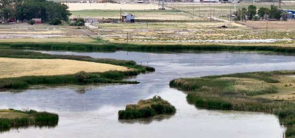
The center also projects that Utah's largest creeks and rivers will experience near-record-low runoff, after the state estimated that they've already experienced their peak runoff.
Why did the outlook worsen
The Colorado Basin River Forecast Center had already projected bleak outlooks for Lake Powell, as well as the Bear, Provo, Sevier, Virgin and Weber rivers and Big Cottonwood Creek, largely because of a record-low snowpack collection across the region.
However, those came with a larger margin of error, and assumed certain conditions based on the past 30 years, plus the outside chance of a massive end-of-season storm.
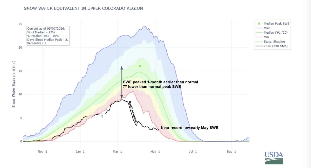
The error rate has now dropped to about 15% across the system, as most of the snowmelt season has played out. April and May storms have helped keep some snowpack in the mountains, but it has only helped the Upper Colorado Basin snowpack to be slightly above the record low for early May.
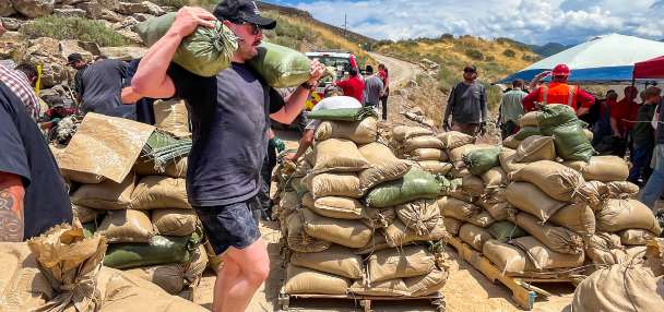
They have only stalled the growth of Utah's drought, but approximately 94% of the state is now in severe drought or worse, including nearly 60% in extreme or exceptional drought — the two worst categories, the U.S. Drought Monitor reported Thursday.
With warmer temperatures and early snowmelt, plants and trees have woken up earlier than usual, creating a "thirtiest atmosphere" to soak up most of the late-season snow, Moser adds. It's also sparked an earlier irrigation season, which means water is pulled from the system earlier than usual.
All of that adds to a reduction of what's expected from this year's snowpack. The new Colorado Basin River Forecast Center outlook for Lake Powell is approximately 600,000 acre-feet less than what it projected last month.
The outlook doesn't account for the water the reservoir will receive from Flaming Gorge. The Colorado River Basin states approved a federal plan last month to release 660,000 acre-feet and 1 million acre-feet of water from the reservoir at the Utah-Wyoming border to help Lake Powell avoid falling to a level below what's needed to generate power.
This has been Utah's worst winter for snowpack going back to at least 1930, and the implications for our surface water supplies this summer are very concerning.
–Jordan Clayton, hydrologist
Those extra inflows are expected to trickle in over the next year, while the states hope to have a much better snowpack next winter.
But the center's outlooks for various creeks and rivers in Utah have also fallen toward some of the worst on record. Bear River and Big Cottonwood Creek are now on track for their second-worst runoffs on record, and it is expected to be in the bottom five for the Provo and Weber rivers, too.
That's based on records that go back 60 to 120 years, while the Sevier and Virgin rivers also face poor outlooks. In an update released on Thursday, Jordan Clayton, a hydrologist for the Natural Resources Conservation Service, agreed that most of the recent moisture did nothing for the region.
"The story of this winter and spring has not significantly changed," he wrote. "This has been Utah's worst winter for snowpack going back to at least 1930, and the implications for our surface water supplies this summer are very concerning."
The end of the season?
Utah's statewide snowmelt traditionally ends in mid-June, but a forecasted heat wave next week could be the dagger in this season. It might produce the first 90-degree day for the Wasatch Front and 100-degree day in and around St. George, along with warm temperatures in the mountains.
Moser notes hints of storms at the other end of the system, which could bring additional snowpack. However, at this point, and depending on what's left after the warmup, he said it's unlikely that any storm will make a dent in the final water outlook.
"The meat of the season has passed us, and it was record warm and dry," he said.
State and local leaders are already bracing for the impacts.
Gov. Spencer Cox said last week that he would likely issue a drought-related declaration of some kind, while cities across the state have implemented various water restrictions.
"We are facing ... a very serious drought," he said.