- Utah faces severe drought with snowpack peaking a month early at record lows.
- The western U.S. also experienced below-average or record-low snowpacks this season.
- The low snowpack may intensify ongoing megadrought challenges in the region.
SALT LAKE CITY — Nearly 60% of Utah remains in severe or worse drought after the state's snowpack peaked about a month prematurely at its lowest level since daily collection began in the 1980s.
Snowpack on April 1 is the lowest since data was first collected in 1930, federal hydrologists added. This signals trouble for smaller reservoirs that rely on snowpack to refill each year, as well as for other reservoirs in central and southern Utah that suffered a difficult season last year.
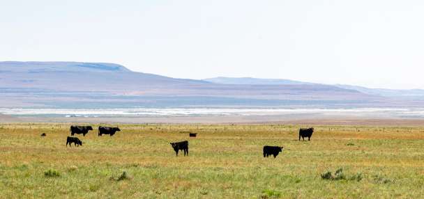
It also opens the state up to other water challenges, earlier wildfire conditions, agricultural damage and possibly fewer recreation opportunities this summer. That requires early planning and coordination to navigate the hurdle, said Joel Ferry, director of the Utah Department of Natural Resources.
He anticipates cities across the state will implement water restrictions and other conservation measures to get ahead of the situation.
Utah's story isn't unique to the West, though. This winter broke all sorts of unwanted records across the West, leaving states that rely on snowpack in an equally tricky dilemma. It's the latest chapter of the "megadrought," a series of large droughts across the region since the turn of the century, that have drained water supplies and dried out vegetation.
"We're going through this generational, millennial drought, and we're in the midst of that," Ferry reiterated on Monday. "That makes this challenge that much greater."
How the rest of the West fared this winter
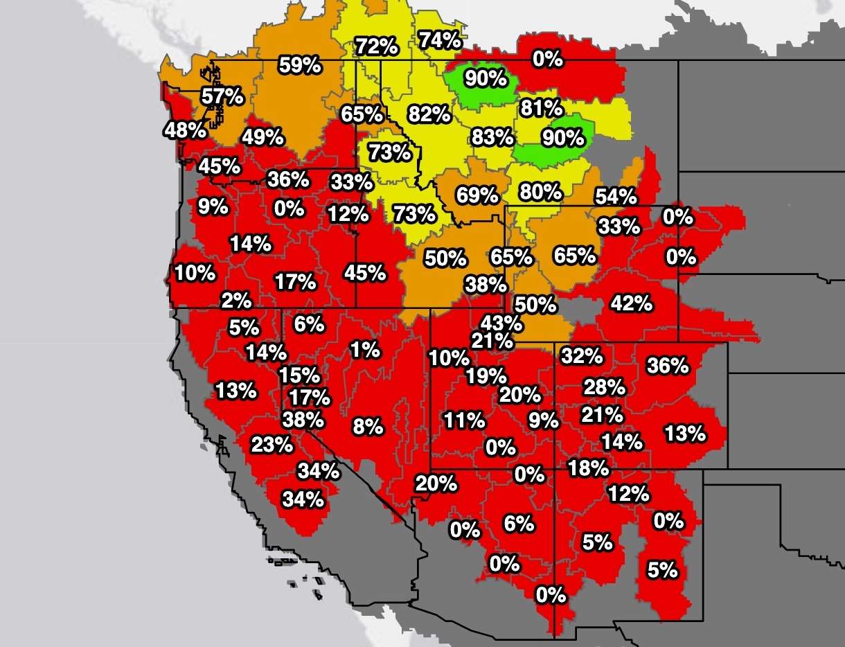
All 11 Western states' snowpacks appear to have peaked at below-normal levels this year, with many — like Utah — reaching record lows or setting record lows at some point this season. California, Montana and Washington were the only Western states that did not have their lowest snowpack levels on record to begin April this year.
Washington led the region in snowpack, which is normally the case, but its peak of 17.6 inches of snow water equivalent this year ended up at 58% of its normal peak. Montana's likely peak of 78% of its median peak was the closest to normal.
The West's 2026 snowpack by state
KSL analyzed Natural Resources Conservation Service data collected from the 11 Western states between Oct. 1 and Monday.
Each state is ranked in order of how it compares to its "normal," which is the median peak total from 1991 to 2020. An asterisk represents a record-low total for April 1 since daily data records began in the 1980s.
Alaska was not included since it's not a part of the contiguous West.
- Montana: 14 inches (78% of median average)
- Wyoming: 12.2 inches (69% of median average)*
- Idaho: 14.5 inches (68% of median average)*
- Washington: 17.6 inches (58% of median average)
- Nevada: 10.2 inches (52% of median average)*
- Utah: 8.3 inches (52% of median average)*
- California: 11.4 inches (51% of median average)
- Colorado: 8.5 inches (51% of median average)*
- Arizona: 3.2 inches (44% of median average)*
- New Mexico: 4.8 inches (42% of median average)*
- Oregon: 4.5 inches (27% of median average)*
Note: Some peaks could change after Monday, but most are unlikely because of snowmelt since mid-March.
Six-month climate data show two clear patterns behind what happened in the West this season. First, most of the moisture ended up toward the northern end of the region, which was expected from a La Niña oceanic pattern. Second, record-warm temperatures impacted the whole region, resulting in subpar snowpack despite decent precipitation totals.
Eight of the 11 Western states experienced their warmest first half of a water year since at least 1895, per the National Centers for Environmental Information data. Idaho and Oregon each ended up 0.1 degrees below previous records, set in 1934 and 2015, respectively. Washington's average temperature was the fourth warmest on record.
Many states mirrored Utah in shattering previous records, all of which led to lower snowpacks. There wasn't much polar air for cooler, snow-producing storms throughout the West this winter because of the lack of organized systems, which contributed to everything, said KSL meteorologist Matt Johnson.
A massive high-pressure system that set up last month also produced the warmest March on record for most areas outside of the Pacific Northwest, which sped up snowmelt and essentially ensured any late-season storms won't surpass current peaks in most states.
The temperature impact was perhaps most pronounced in Oregon. Its snowpack may have peaked at 4.5 inches of snow water equivalent, 27% of its median average, and the same peak as its record warm year in 2015. That's despite a mountain precipitation total of 31.6 inches of water between October and Monday, slightly below 2015 and 87% of its median average.
Planning for impacts
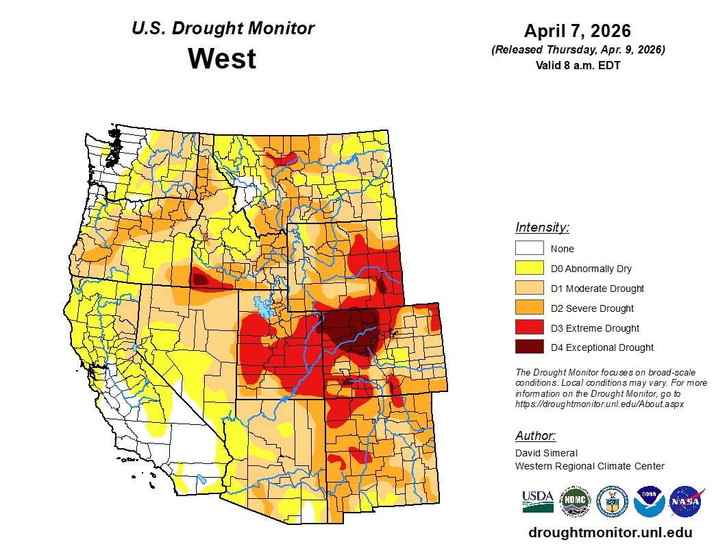
Moderate drought covers about two-thirds of the West, while almost 13% is listed in severe or worse drought, according to the U.S. Drought Monitor. The worst of it centered over the Colorado River headwaters.
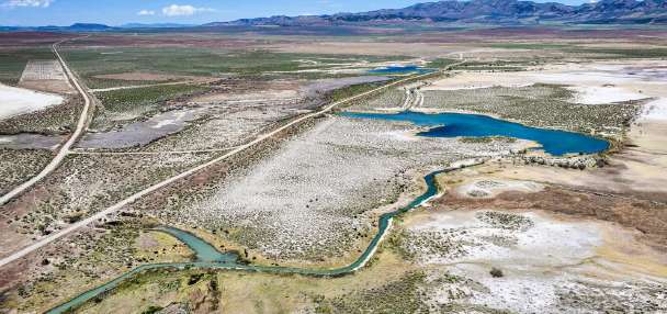
Record-low snowpack throughout the Colorado River's Upper Basin and premature snowmelt are also key reasons why Lake Powell could experience its worst snowmelt inflows this year, according to the National Weather Service's Colorado Basin River Forecast Center.
"The probability of new record low spring and summer runoff volumes has increased," the National Integrated Drought Information System wrote in a report earlier this month of streamflow forecasts across the region.
That will ultimately depend on the weather over the rest of meteorological spring, but other Western states and communities are already thinking like Utah as the water-building season transitions into the water-consuming season.
Cities like Edgewater, Colorado, have enacted new water restrictions to conserve what they have, citing a possible 20% reduction in water from their supplier, Denver Water. News outlets have reported similar cutbacks in other parts of the Continental State.
Colorado River Basin states could face large cutbacks from a new agreement on the system's water being negotiated this year, too.
States are also thinking about the upcoming fire season.
Low snowpack is part of the equation in determining a severe fire season, along with preseason rain, drought conditions, heat waves, thunderstorms and lightning, Natalie Weber, a spokesperson for the Oregon Department of Forestry, told SFGATE.
"For that reason, we usually prepare for the worst and hope for the best," she told the outlet.