Estimated read time: 3-4 minutes
- Wind and snow advisories are issued in Utah as storms persist into weekend.
- Wind gusts up to 65 mph expected in mountains until late Friday, the National Weather Service says.
- Some mountain areas could receive close to a foot of snow by the end of Sunday.
SALT LAKE CITY — More windy and wet weather is in parts of Utah's forecast as an active pattern continues into the weekend.
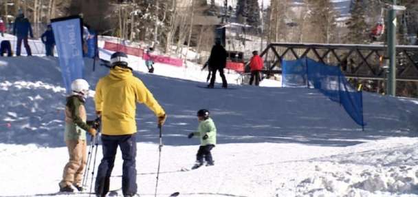
The National Weather Service issued wind advisories for the northern Wasatch Mountains as another cold front sweeps through the region. However, gusts won't be quite as strong as they were on Wednesday, when gusts exceeded 100 mph in some mountain areas and valley gusts surpassed 60 mph, said KSL meteorologist Matt Johnson.
That's because the jet stream and low-pressure system essentially coupled together in a way that created an "intense shot of wind" as the cold front moved through on Wednesday, he explained. It also led to downsloping off some mountains, which boosted winds further in some cases, and contributed to a new record-high temperature in Salt Lake City.
That's not expected on Friday, but gusts of up to 65 mph are possible in the mountains until late Friday, which is when the weather service's advisory expires.
A wet weekend
Another weather service advisory goes into effect in the area by the time the wind advisory expires. Federal forecasters issued a winter weather advisory for the Uinta Mountains because of a jolt of moisture in Utah's northern half.
That's because Wednesday's cold front opened the door for more valley rain and mountain snow in the region, Johnson said. Meanwhile, an atmospheric river is making it way through the West in an unorganized manner.
"It's dipping into California and headed up into Idaho, and what will happen is that it will drop south into northern Utah and (see-saw between Utah and Idaho). And then, finally, it's going to lift up (early next week)," he said.
As a result, it's producing off-and-on showers throughout Utah's northern half this weekend. A pulse of moisture that will pass through the northern half of the state Friday evening, which can linger into early Saturday. Another round of storms is expected Sunday morning, before drier conditions return.
Still, it has the potential to deliver a decent amount of precipitation in the drought-plagued state. The weather service's advisory states that the West Uintas could receive 6 to 12 inches of snow by Saturday evening.
While not included in the advisory, the Wasatch Mountains could receive 5 to 10 inches of snow by the end of the weekend, according to a weather service model. The agency adds that some mountain locations could receive 1 to 2 inches or more of precipitation.
A cold front will lower snow levels overnight across far northern areas, down to valley floors following the heaviest precipitation. However, this cooldown will be short-lived as more warm advection arrives Saturday along decaying atmospheric river moisture. #utwxpic.twitter.com/Ylxwyf5Uez
— NWS Salt Lake City (@NWSSaltLakeCity) December 19, 2025
Some valley snow is possible, especially in the Cache Valley, but any snow is expected to be brief because of the atmospheric river's warmth, the weather service adds. It notes that 0.25 to 1 inches of precipitation or more is possible in the Wasatch Front and northern Utah valleys, with higher totals more likely toward the northern end of the region.
It comes as state water managers acknowledged Utah's slow snowpack start on Thursday. Utah's statewide snowpack is currently 55% of the median average for this point of the year, just above its record-low for this point of the year, but it's also very early in the season.
"Two or three good storm cycles could bring the state up to normal levels. Utah's snowpack typically peaks around the beginning of April," the Utah Division of Water Resources wrote in its water update.
More on the way?
Approximately 94% of the state is in moderate drought, a slight increase from past weeks, but more moisture is forecast to impact the state in the final full week of 2025. While things could dry out by Monday, Johnson says a more "potent" storm could be in Utah's cards next week, potentially reaching southern Utah, too.
Preliminary models hint that a strong mix of valley rain and mountain snow could impact Utah on Christmas Eve and Christmas Day, although it's unclear yet how much moisture the storm would provide. More detailed projections are expected in the coming days.
Full seven-day forecasts for areas across Utah can be found online at the KSL Weather Center.