Estimated read time: 5-6 minutes
This archived news story is available only for your personal, non-commercial use. Information in the story may be outdated or superseded by additional information. Reading or replaying the story in its archived form does not constitute a republication of the story.
- The first storm of December broke Utah's dry spell, delivering more significant snow than expected.
- A stronger storm is forecast for this week, prompting a winter weather advisory for the Wasatch Mountains.
- Long-range forecasts predict above-normal temperatures and below-normal precipitation will reemerge before Christmas.
SALT LAKE CITY — The first of a pair of storms forecast to impact Utah this weekend ultimately overperformed weather models, snapping an abnormally dry start to December for the Beehive State — and there's more on the way.
The wave, part of a system moving in from the California coast, delivered a foot of new snow at the Alta Ski Area by Friday afternoon, the resort reported. Several other resorts in the area reported a nice new coating as well.
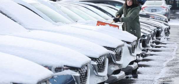
It even delivered a few inches of snow in valley areas, including as much as 4 inches in Clinton, creating some commute headaches because of the timing of the storm.

KSL meteorologist Matt Johnson explained the storm was a "pleasant surprise" for skiers, snowboarders and water managers alike, as models had initially indicated that the system would weaken as it moved out of California. However, he said the system's "dynamics" stayed intact better than projected, reaching low probability levels outlined in the weather models.
He chalks it up to the "unpredictability" of weather even with advancements in technology. It could bode for the second wave, which figures to be even stronger but was also initially projected to be small.
The storm is forecast to reach Utah by Saturday afternoon, starting with a mix of valley rain and mountain snow. Johnson said a cold front pushing through the region Saturday night and Sunday morning will help produce more valley snowfall across the state's northern half that will linger into mid-Sunday morning.
The system is forecast to clear out by the end of the day.
A winter storm will impact the northern Utah mountains from Saturday afternoon through Sunday afternoon, bringing 6 to 12 inches of snowfall, with locally higher amounts in favored terrain. Be sure to get the latest forecast at https://t.co/FmlUW31lgE#utwxpic.twitter.com/GAIyMDpuqf
— NWS Salt Lake City (@NWSSaltLakeCity) December 14, 2024
The National Weather Service on Friday issued a winter weather advisory for the Wasatch and West Uinta mountain ranges ahead of the next wave. It goes into effect at noon Saturday and lasts through Sunday afternoon, where the mountains could receive another 6 to 12 inches of snow — and possibly even up to 18 inches in parts of northern Utah's mountains.
Northern Utah valleys are projected to receive a trace to an inch or two of additional snow, while higher totals are expected in the valley benches and Wasatch Backcountry.
"Hopefully, this is a sign that we're going to get things going," Johnson said, adding another small system could arrive early next week.
Full, seven-day forecasts for areas across Utah can be found online, at the KSL Weather Center.
Breaking a trend
Friday's storm provided some of the first moisture during what is normally one of Utah's wetter months.
Salt Lake City hadn't received any moisture before Friday morning, though it typically receives about 1.4 inches of precipitation in December. The same was true for valley communities across the state.
A cold front system that broke a long-standing inversion last weekend failed to produce much moisture. Mountain locations are also off to a slow start to winter. One of the weather service's Alta sites, which normally receives nearly 28 inches of snow in December, had only received 4 inches of snow a few days before the month's midway point.
It follows what ended up being a warmer and drier meteorological fall than what Utah normally receives, per federal climate data released earlier this week.
The National Centers for Environmental Information reported that — with an average statewide temperature of 52.1 degrees — this year's meteorological fall was Utah's third warmest since at least 1895. The final average was 1.1 degrees off a record set in 1963 and 0.1 degrees off another unseasonably warm fall in 2001.
It was also the state's 33rd driest fall in 130 years. The state averaged just 2.4 inches of precipitation in September, October and November. Larger storms toward the latter half of the season were beneficial, though, bumping up November precipitation totals to 130% of normal at Natural Resources Conservation Service soil climate sites scattered across the state.
Statewide soil moisture levels ended the month at about 33% saturation, but it remains in the 30th percentile for the end of the season, Jordan Clayton, a hydrologist for the agency, wrote in a report last week. Soil moisture is considered a key factor in snowpack runoff efficiency every spring, which accounts for about 95% of the state's water supply.
Utah's snowpack — a collection of water in the snow — ended the month slightly above the median average for the end of November, but it had since fallen back down to 81% before this week's storms.
"(It's) really one of the slower starts we've seen in some number of years," added Glen Merrill, a hydrologist for the National Weather Service, in an interview with KSL-TV this week.
What about the rest of winter?
While there is some moisture possible early next week, current long-range outlooks don't look promising for Utahns dreaming of a white Christmas. The National Weather Service's Climate Prediction Center released two-week outlooks slightly beyond Dec. 25, which list Utah as having a higher probability of above-normal temperatures and below-normal precipitation around the holiday.
Wish this wasn't showing up in model trends but we're seeing a high pressure ridge set up camp leading into Christmas. Still time for change, but I don't like what I'm seeing so far. #utwxpic.twitter.com/4K3zXDjmG2
— Matthew Johnson (@KSL_Matt) December 11, 2024
Beyond that is anyone's guess. Johnson said the generally dry trend can easily continue into 2025, but Merrill said trends in the first half of the snow collection season don't always carry over. Last winter's snowpack, for example, reached the halfway point of the season at 69% of the median average, but a second-half moisture surge created another above-normal collection.
"It can actually change on a dime," he said. "Just because we start slow doesn't mean that we're going to stay slow throughout the remainder of the winter."
Long-range outlooks for the full season don't offer many indications as to whether Utah is in for a dry or wet winter.
The good news in either scenario is that Utah's reservoirs are in a good spot for at least 2025. Per the Utah Division of Water Resources, the state's reservoir system remains about 75% full, about the same as last year and 20 percentage points ahead of the median average for December.
Contributing: Andrew Adams


