Estimated read time: 3-4 minutes
- Utah faces another winter weather advisory as storms bring beneficial moisture statewide.
- Southern mountains may receive 6-12 inches of snow by Wednesday.
- Recent precipitation helps, as moderate drought or worse persists in 94% of Utah.
SALT LAKE CITY — A storm system that slammed into Utah over the weekend provided beneficial moisture across the state.
Kaysville received 1.13 inches of rain by noon on Monday, while Brigham City and Cedar City each ended up with over an inch of precipitation. Parts of the Wasatch Front also received a half-inch of rain, showcasing how the somewhat unpredictable pattern produced across both northern and southern Utah.
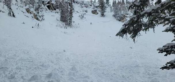
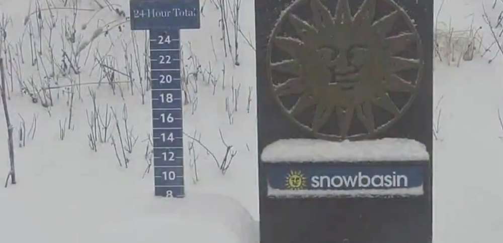
Utah's resorts, some of which have had to delay their openings because of the lack of snow, celebrated their biggest haul in weeks. Snowbasin Resort celebrated 8 inches of new snow, while Brian Head Resort reported over a half-foot, as well, putting it on track to open this weekend.
"This was widespread," said KSL meteorologist Kristen Van Dyke.
And there's more to come in what figures to be a wet week for the state.
More moisture, cooler temperatures in Utah
The National Weather Service issued another winter weather advisory for the southern mountains, which could receive up to another 6 to 12 inches of snow between Monday night and Wednesday morning. Places like Brian Head have about a one-third probability of receiving a foot of snow by early Thursday, according to one weather service model.
The additional moisture is in relation to a low-pressure system that will likely follow the same track as the one that passed through the state over the weekend, Van Dyke explains. The second system was still delivering moisture across California on Monday, but she said it's expected to move southeast toward southern Utah before clipping northern Utah as it continues east.
However, it's a similar cutoff low-pressure system, meaning its path and potency are difficult to project.
A weather system lifting into southern Utah tonight brings widespread precipitation that continues through Wednesday. Accumulating snowfall is expected above 8000 feet, resulting in slushy conditions for mountain routes that may lead to periods of difficult travel. #utwxpic.twitter.com/pkxCBiDNWh
— NWS Salt Lake City (@NWSSaltLakeCity) November 17, 2025
Most of the moisture is expected to reach southwest Utah by Tuesday morning, intensifying in waves throughout the day. It'll bring a mix of valley rain and mountain snow, most of which will remain within Utah's southwest and southeast. Snow accumulations will likely form near 8,000 feet elevation, but the snow line could drop to 6,500 feet elevation late Tuesday, the weather service notes.
Additional showers are forecast for those regions at times throughout the day on Wednesday as the system moves east, but there's also a chance that storms will reach the Wasatch Front on Wednesday, Van Dyke said. Some weather models indicate a possibility of rain in the region on Thursday morning, but any precipitation depends on where the center of the low ends up and if it has enough power to reach the area.
Weather service models project that parts of southwest Utah could receive 0.5 to 1 inch of precipitation by early Thursday, while the Wasatch Front may only end up with 0.10 inches or less. Higher numbers are possible if the core of the storm ends up closer to Utah, while lower numbers are possible if it ends up closer to Mexico.
It comes as drought continues to plague the state. About 94% of Utah remains in at least moderate drought, including over 40% in severe or extreme drought, according to the U.S. Drought Monitor.
Meanwhile, cooler temperatures are also expected as the week continues. High temperatures across the Wasatch Front are forecast to dip from the mid-50s on Monday and Tuesday to the mid-40s by the end of the workweek, with overnight lows hovering near the freezing line. High temperatures near St. George could drop to the mid-50s.
Full seven-day forecasts for areas across Utah can be found online at the KSL Weather Center.