Estimated read time: 3-4 minutes
This archived news story is available only for your personal, non-commercial use. Information in the story may be outdated or superseded by additional information. Reading or replaying the story in its archived form does not constitute a republication of the story.
- Utah's snowpack climbed back to 93% of its median average.
- State water managers still anticipate below-average streamflows due to low snowpack levels and dry soil.
- Officials urge water conservation as drought conditions worsen, affecting 75% of the state.
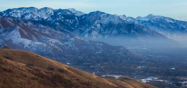
SALT LAKE CITY — Utah's snowpack jumped back to 93% of its median average for this point in the season this week, and it stands to benefit further with another storm rolling in.
However, with several regions well below normal, lulls in the long-range forecast and dry soil conditions before the snowpack collection began, state water managers are bracing for a below-normal runoff across most of the state as that snow melts.
"While we still have some time before our snowpack typically peaks in April, most of our basins are likely to experience below-average streamflows this spring runoff," said Candice Hasenyager, director of the Division of Water Resources, in a water conditions update the division released on Wednesday.
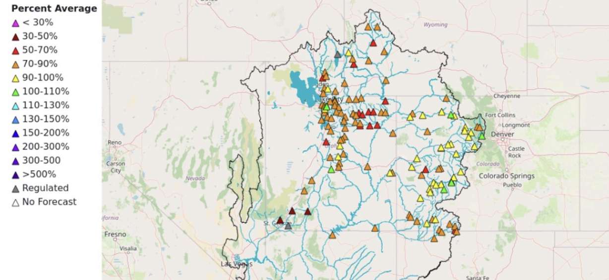
Utah's snowpack remains divided between regions despite a storm that benefitted the whole state last week. All of the basins by the Wasatch and Uinta mountains returned to 90% or higher by this week, led by the Bear River Basin's 109% for mid-February.
Those basins will also receive another boost before this weekend.
It's a different story elsewhere. Several central Utah basins also jumped back to near or over 80%, but many other basins in the region and southern Utah are running at less than 60%.
Southwestern Utah's snowpack collection had fallen to its worst level since at least 1980 on Jan. 20, but it climbed out of record-low status with the statewide storm that ultimately doubled its season total. Still, it and the Escalante-Paria basin's total is running at 39% of normal, the lowest percentage of normal across all basins.
Yet, there were below-normal soil moisture levels across the state before any of the snow collection could threaten the production of the spring snowmelt, which typically begins in early April.
Jordan Clayton, a hydrologist for the Natural Resources Conservation Service, explained last month that soil moisture levels are essentially locked in place once meaningful snowfall begins, remaining there until the spring. Since it was below normal, more water will likely go toward recharging underground reservoirs.
"Some of that water that would have otherwise made it downstream will just wind up getting soaked up by the headwater soils," he said at the time.
That's essentially what the National Weather Service's Colorado River Basin Forecast Center expects will happen this spring. Aside from some exceptions, it projects most of Utah's creeks, streams and rivers will receive 50% to 90% of their normal snowmelt this spring. Southwest Utah streams are on track to end up at less than 50%. Even worse projections are in place across Arizona.
About 95% of Utah's water supply comes from the snowpack collection and spring snowmelt process.
The bright side is that Utah's reservoirs remain in a good place before the snowmelt. Utah's reservoir system is now about 80% full, slightly ahead of this time last year and 20 percentage points ahead of the February median average. But with a poor snowmelt outlook, some reservoirs may struggle to fully refill like the past two above-normal winters.
Drought conditions are also far worse than the last two years, as extreme drought returned to Utah earlier this month for the first time since 2023's record snowpack. Over three-fourths of the state is now in at least moderate drought, including one-fifth that's in severe drought or worse, per the U.S. Drought Monitor.
State water officials are urging residents to conserve water ahead of the next irrigation season in case the situation worsens.
"With low precipitation and an underperforming snowpack, we must continue using water wisely to maintain our quality of life," Hasenyager said.