Estimated read time: 4-5 minutes
This archived news story is available only for your personal, non-commercial use. Information in the story may be outdated or superseded by additional information. Reading or replaying the story in its archived form does not constitute a republication of the story.
- Many Utahns may experience a white Christmas through an incoming storm.
- The storm is expected to improve air quality and possibly deliver valley snow, especially in central and southern Utah.
- Additional moisture is expected later in the week.
SALT LAKE CITY — Many Utahns could wake up to a white Christmas this year — or at least cleaner air.
A small storm is forecast to join Santa on his route, passing through the state between late Christmas Eve and early Christmas Day. Projected precipitation totals aren't overly impressive, though, the system comes with a decent probability for at least some measurable falls, favoring parts of central and southern Utah.
Storm timing
The projected system follows another small system that passed through Utah's northern half Monday, delivering 0.20 inches or more around Ogden and northward, including as much as 0.37 inches of precipitation in Brigham City. The storm dipped into Salt Lake City, producing some showers there, as well.
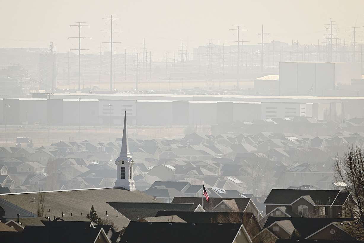
However, it did little to clean up the air.

Johnson explains the storm wasn't very "dynamic," with not enough cold air to push out a high-pressure system that has dominated Utah's weather pattern since last week and not enough wind to clear out the Wasatch Front's latest inversion. Instead, the storm slammed into the high-pressure system and weakened as it crossed through Utah.
"We did clean out the air just a touch, up in Ogden ... but, still, it didn't mix out," he said.
The next system is expected to provide an air-quality gift while also delivering a white Christmas. It's forecast to arrive from the West, potentially splitting up into two pieces as it likely reaches Utah after 9 p.m. on Christmas Eve. A mix of rain and snow is forecast throughout most of the state, lingering into Christmas morning — where rain is expected to switch into snow — before the system clears out later in the day.
Who gets a white Christmas?
The incoming storm could deliver almost a foot of snow in places like Brian Head and Alta, but lower-elevation areas could also receive snow.
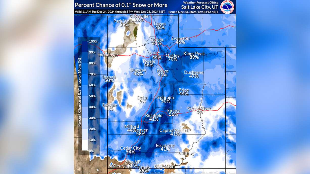
The National Weather Service updated its snow probability models Monday morning, giving many Utah areas a 25-60% probability of receiving at least 0.1 inches of snow over the next few days. Aside from the mountains, the highest probability lies in Beaver, which has a 58% chance; St. George — to no surprise — has the lowest probability overall.

Johnson said he'd give the Wasatch Front more of a 20-40% probability of at least 0.1 inches just because it's a relatively warm storm for late December and the southern half of the two-piece system is often stronger. The weather service notes that communities in southwest and central Utah like Beaver, Cedar City, Ephraim and Richfield have the highest probabilities (between 15-31%) of at least 2 inches of snow by early Thursday.
How much precipitation lasts as the system enters Utah and when rain switches to snow will likely lead to how much snow communities receive, Johnson adds. Weather service meteorologists note that some models are also split between two "equally likely" scenarios involving the storm tracks, one of which would provide more moisture to northern Utah. That would increase snow probabilities in lower elevation areas.
Any measurable new snow would be a rarity of sorts, at least for Salt Lake City. The National Weather Service has tracked the city's white Christmases since 1952 through different definitions. If Utah's capital receives 0.1 inches on Wednesday, it would be the first white Christmas since 2019 — based on the definition that it snows at least 0.1 inches on the holiday. That has only happened 11 times in the past 72 years.
The other white Christmas definition is snow on the ground before Christmas Day, which is more common in Utah's capital city. There were still 2 inches on the ground on Christmas Day two years ago; there was at least 1 inch on the ground 35 other times since 1952.
More to come
While most of the low-elevation snow will likely melt by the end of Christmas, Johnson said a few unorganized lingering waves of moisture are expected to pass through the state to close out the week. These, he said, could produce a "nice tap of moisture" in the mountains.
Those waves will likely also produce some additional rain and snow showers in the valleys. Warmer and potentially drier conditions are forecast for the final weekend of the year.
Full seven-day forecasts for areas across Utah can be found online, at the KSL Weather Center.


