Estimated read time: 4-5 minutes
This archived news story is available only for your personal, non-commercial use. Information in the story may be outdated or superseded by additional information. Reading or replaying the story in its archived form does not constitute a republication of the story.
SALT LAKE CITY — Utah officially posted its second-hottest summer on record, but a rainy August may have helped the state avoid more serious drought conditions from returning.
Utah's average temperature throughout the meteorological summer — June 1 to Aug. 31 — reached 72.7 degrees, 4.4 degrees above the state's 20th century average and just 0.3 degrees off its seasonal record set in 2021, according to National Centers for Environmental Information data released Tuesday.
Utah's heat averages follow a trend that emerged in recent decades. The state's 16 hottest summers have all come in the last 30 years, mirroring global trends. It was also the hottest summer on record for nine counties in Utah's southern half.
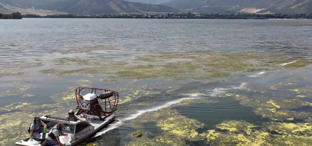
However, a late-season monsoonal surge helped boost Utah's average summer rainfall collection. According to the agency, the state, collected 2.85 inches over the season, about 0.09 inches below the 20th century average and the 61st wettest out of 130 summers dating back to 1895.
Differing summer patterns
The data encapsulates two predominate weather patterns meteorologists observed this summer. Julie Cunningham, a meteorologist for the National Weather Service's Salt Lake City office, explained more high-pressure systems in June and July, delaying the state's monsoon season and raising temperatures.
Fourteen of Salt Lake City's 20 100-degree days this summer came in June and July, while several counties — mostly in southern Utah — were on pace for record-high average temperatures.
The few storms that popped up over these two months generally benefited parts of northern, southeast and west-central Utah more than other parts of the state. Every county in the state ended July with a deficit from the 20th century average, but the deficits ranged from as low as 0.08 inches in Grand and San Juan counties to as high as 1.83 inches in Davis County.
The dry spell left Utah on pace for its 19th-driest summer since 1895 after July.
High-pressure systems over the West began to shift east of Utah around the end of July and the start of August, Cunningham said. This opened the door for monsoon moisture from the Gulf of Mexico to enter Utah.
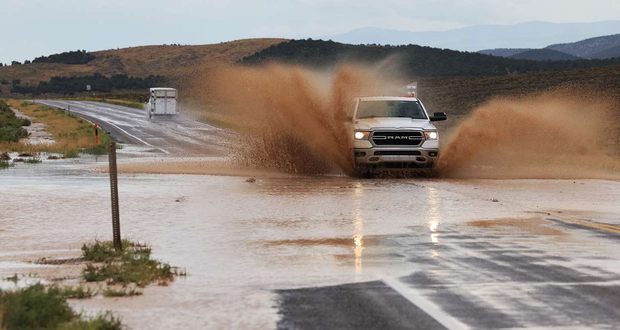
The Beehive State, on average, collected 1.93 inches of precipitation last month, accounting for over two-thirds of the precipitation the state received throughout the season. Its 19th-wettest August on record hoisted the summer up from being the 19th driest to the 70th driest — or 61st wettest — in 130 seasons.
Every county besides Box Elder received a surplus from the August average, while several towns and cities collected a season's worth of rain at once from storms. These storms hit south-central Utah the most; Garfield, Piute and Wayne counties all ended up with precipitation totals that landed in their respective Top 10 wettest Augusts on record.
Summer totals
This summer was ultimately a feast or famine for Utah's regions.
Southeast, south-central and west-central Utah counties — like Garfield, Grand, Millard San Juan, Sevier and Wayne — all ended up with summer surpluses. The largest deficits were recorded in northern and southwest Utah, as well as the Wasatch Front, Wasatch Back and West Desert areas. Cache, Davis, Iron, Morgan, Summit Washington and Weber counties also ended up with collections that fell over an inch below average.
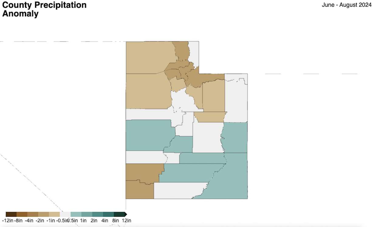
Most of this has to do with how the high-pressure systems are set up. Cunningham points out that storms often set up a little more east than usual this summer, benefiting southeastern and south-central Utah more than southwestern Utah.
It's also likely why Colorado and New Mexico were the only two states with above-normal precipitation totals across the West this summer.
"It really just depends on each individual surge," Cunningham told KSL.com. "It just so happened that the culmination of all those surges resulted in higher precipitation across southeastern Utah rather than further west."
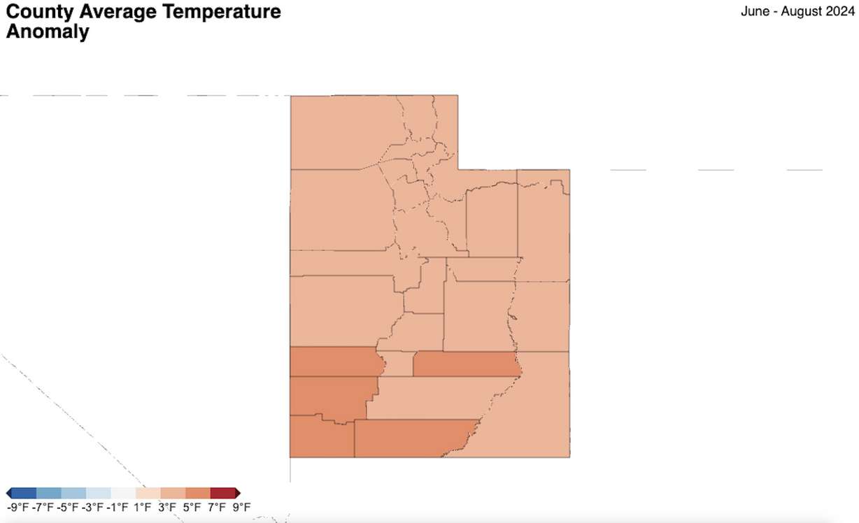
Even with the rain helping to cool down temperatures in August, nearly all of the counties in southern Utah broke average temperature records this summer. It was the hottest summer on record for Beaver, Garfield, Iron, Kane, Millard, Piute, San Juan, Washington and Wayne counties.
Utah drought update
It's no surprise the regions with the largest summer deficits also account for the driest conditions in Utah as the 2024 water year comes to an end.
The U.S. Drought Monitor reports that nearly 10% of the state is in moderate drought, including all of Washington County — as well as large chunks of Iron, Kane and Tooele counties and small parts of Beaver and Garfield counties.
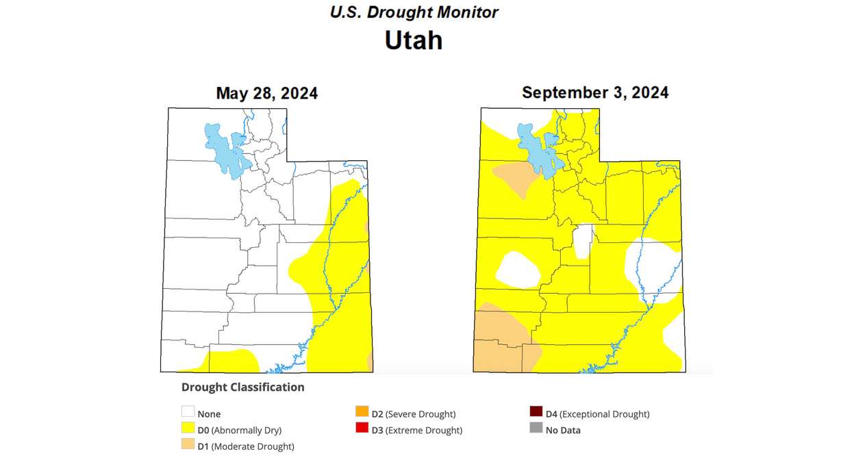
Another 75% of the state is listed as abnormally dry, while no listing exists within pockets of southeast, central and northwest Utah. The Natural Resources Conservation Service reported last week that August rains help slow down the drying soil conditions, keeping the average saturation level the same between the end of July and the end of August.
It left soil moisture just 7% lower than at the end of summer last year. Fall is usually when more consistent storms return to the state and additional moisture could put the state in position for another efficient snowmelt next spring depending on this winter's snowpack collection.
The snowpack collection and snowmelt process accounts for about 95% of the state's water supply.
"Increasing soil moisture is good in any season, especially heading into winter," Cunningham said. "Hopefully, we get a good snowpack this year."