Estimated read time: 4-5 minutes
- Recent storms increased Salt Lake City's seasonal snowfall total to 18.1 inches and counting.
- Its seasonal total finally surpassed 1933-34, avoiding the city's lowest total on record.
- Meteorologists attribute changes to colder storms arriving in Utah, a shift from storms earlier this season.
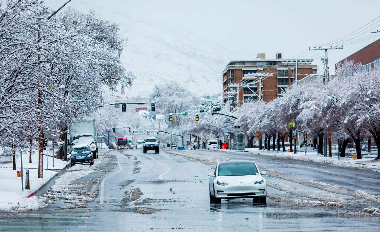
SALT LAKE CITY — Jeremy Morgan was one of many residents who spent Tuesday morning clearing out their own or a neighbor's driveways after the Wasatch Front received several inches of snowfall overnight.
Mid-March valley snowfall is very normal in Utah, but the latest storm pattern has been a bit of a rarity this season. The last few storms have finally helped Salt Lake City avoid a record set over nine decades ago.
With 3.4 inches of snow at Salt Lake City International Airport between Monday night and Tuesday morning, the latest storm is Salt Lake City's largest snowstorm of this season, surpassing all storms that passed through during meteorological winter (the three calendar months with the lowest average temperatures). Some additional snowfall was possible through Wednesday morning, which could extend the total. Some other parts of the city received as much as 9 inches of snow.
As of noon Tuesday, Utah's capital city extended its seasonal snowfall to 18.1 inches with the latest storm. The running total also surpassed 14.3 inches on Sunday, which — set during the 1933-1934 season — remains the lowest seasonal snowfall total Utah's capital has recorded since the National Weather Service began collecting city weather data in 1874.
So how did Salt Lake City almost break a record set 91 years ago, and why did trends suddenly change?
It all has to do with storm dynamics over the past few months. Utah's meteorological winter — a period from Dec. 1, 2024, through Feb. 28 of this year — mostly produced two storm types: drier cold fronts that came in from Canada or wetter storms that tapped into the air from the southwest, which kept them warm enough to not produce much valley snow, Alex DeSmet, a meteorologist at the National Weather Service, explained back in January.
Some storms broke these trends, but Salt Lake City received 2.99 inches of precipitation throughout meteorological winter but just 10.4 inches of snowfall. It normally receives 4.13 inches of precipitation during the season, including 35.5 inches of snow, based on records from 1991 to 2020.
That differs from the 1933-1934 season, which was part of the city's driest water year on record. Salt Lake City received just 8.16 inches of precipitation from Oct. 1, 1933, through Sept. 30, 1934, during what was one of Utah's hottest and driest periods in modern history.
The two storm dynamics also led to major shifts in snowpack totals across regions, helping northern Utah have a fairly normal season, while southern Utah ended winter on the brink of a record-low snowpack collection.
However, to the delight of some and the dejection of others, recent storms have essentially merged the two trends into a more familiar wintery pattern, says KSL meteorologist Matt Johnson.
He explains that low-pressure systems have formed over the Bering Sea and dropped into the Gulf of Alaska, gathering moisture before entering the Pacific Northwest and then Utah. They've brought in northwest wind flow, which is a key factor in Utah's valley snow.
"The last couple of storms have definitely been colder," he said. "Earlier in the year, we were seeing a lot of subtropical influence — we were seeing the storms bringing a ton of water, but they weren't bringing the cold air. ... This time, we're getting the storm with the full package."
Salt Lake City's seasonal snow total, as of noon Tuesday, is the fourth-lowest all-time, but it could continue to move away from record lows over the next few weeks if the stormy trend can continue. April 16 is the city's average last day of snowfall.
The latest storm also produced impressive valley numbers in other cities:
- Providence, Cache County: 10 inches.
- Fillmore: 9 inches.
- Tooele: 9 inches.
- Bountiful Bench: 8 inches.
- Centerville: 5 inches.
- Holladay: 4 inches.
- South Jordan: 4 inches.
More importantly, snow has fallen in the mountains across all of the state's regions again, raising the statewide snowpack average to 101% of its median average for this point in the year, as of noon Tuesday. Many basins across northern Utah are above 100% of its mid-March average, while central Utah sites are back to 73% to 102% and southern Utah sites are 48% to 81% of average — leaping out of record-low status.
Johnson said some additional snowfall is possible Wednesday morning, while mountains are on tap to receive additional snow on Thursday and Saturday.
Full seven-day forecasts for areas across Utah can be found online, at the KSL Weather Center.