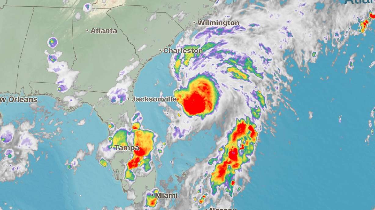
- The National Hurricane Center said Tropical Storm Chantal formed off the Southeast coast Saturday.
- The storm could cause heavy rain in parts of the Southeast and risky beach conditions.
MIAMI — Tropical Storm Chantal formed off the Southeast coast early Saturday morning, becoming the third named system of the Atlantic hurricane season, according to the National Hurricane Center.
While the storm is the first of the season to impact the United States, it isn't a major threat to land, but could drench parts of the Southeast and create risky beach conditions through the weekend.
The center of the storm was about 100 miles away from Charleston, South Carolina, Saturday afternoon and will continue to slowly creep toward the coast into early Sunday morning. The storm will strengthen some through Saturday night, but is expected to make landfall in South Carolina as a tropical storm potentially during the earliest hours of Sunday morning.
Landfall will likely occur somewhere between Charleston and Myrtle Beach, South Carolina.
A tropical storm warning was in place Saturday for portions of the South Carolina and North Carolina coasts.
The latest forecasts suggest the storm will kick off several rounds of thunderstorms that could drop more than 2 to 4 inches of rain on parts of the Carolinas, with isolated amounts of up to 6 inches by Monday.
The system is expected to bring 1 to 2 feet of storm surge in areas of onshore winds. Additionally, rough surf and rip currents will continue to plague much of the Carolina coastline through the holiday weekend.
Outside of the Southeast, most of the country will see ideal conditions for July 4th weekend, particularly in the Northeast and West, where calm, mostly clear skies are expected. The Southeast is likely to dry out by Tuesday.
Texas and the Upper Midwest could continue to see strong to severe thunderstorms with damaging winds and hail through the weekend. Torrential rainfall triggered deadly flooding in Texas early Friday morning as rivers rushed beyond their banks and flooded nearby campgrounds and homes.


