Estimated read time: 4-5 minutes
This archived news story is available only for your personal, non-commercial use. Information in the story may be outdated or superseded by additional information. Reading or replaying the story in its archived form does not constitute a republication of the story.
SOUTH JORDAN — If you’ve ever searched your home on Google Earth, you’ll know what fun it is to bop around looking at the aerial image of a place you’ve seen a million times from the ground. It’s a quick — and free — way to visit everything from your neighbor’s backyard to the top of Mt. Everest.
While Google Earth’s beauty lies in its accessibility to anyone with an internet connection, there are those searching for something a little more precise, even if it comes at a price.
Enter Nearmap.
Nearmap is an Australian-based aerial imagery company that recently expanded to the U.S. and decided to locate its stateside headquarters in none other than South Jordan. Nearmap has created an immense, cloud-based library of updated and high-resolution aerial imagery that anyone — from realtors to solar companies — can use with a subscription customized to their usage.
While high-resolution imagery has historically been available to government or military only, Nearmap wants to give other companies and individuals access to the same data and technology.
“The company started off as a pretty simple premise which is, if we could change the way our customers view the world, we could really transform the way that they work,” said Patrick Quigley, Nearmap’s senior vice president and general manager of North America.
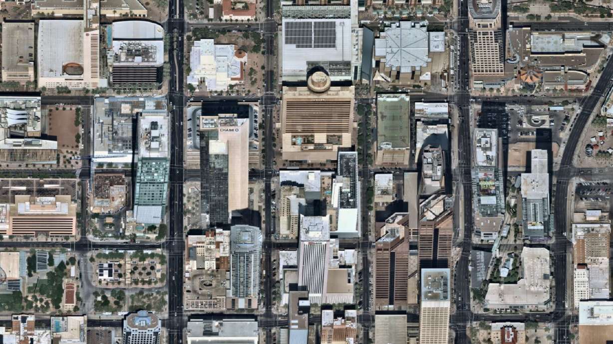
Nearmap has captured just under 70 percent of the U.S. population by flying overhead taking thousands of high-res pictures, then stitching those pictures together into a seamless image. Unlike many competitors, Nearmap flies frequently, covering a metropolis like Salt Lake City around three times a year.
Clients can then peruse aerial imagery of the city from just a few months prior and make accurate measurements or see how construction projects have progressed.
The Hale Center undergoes construction.Nearmap has recently focused efforts on areas of destruction in Houston and Florida following hurricanes Harvey and Irma and hopes up-to-date aerial imagery can help first responders, law enforcement and disaster relief agencies navigate their way through a city. The imagery can also guide utility and telecom companies to downed power lines and assist city officials to assess flood damage.
For victims who experienced severe damage to their home, Nearmap can help insurance companies quickly file claims by providing access to imagery of the area before and after the hurricane.
Nearmap has a diverse set of clients, even catering to food trucks that use the imagery to scope out construction sites and position themselves nearby, Quigley said. The company sees the most interest, however, from local government, architecture, construction and engineering firms, insurance companies and the world of solar energy.
Nearmap, in fact, has already entrenched itself in the booming, local solar scene of the Beehive State.
“Before we got Nearmap, we were just using Google Map imagery or Bing maps, that kind of stuff,” said Tyler Soukup, director of analytics for Utah company Auric Solar. “Obviously it wasn’t nearly as clear, not as sharp, not quite as updated as Nearmaps. … It was a no-brainer. We’ve gotta use this stuff instead.”
Thanksgiving Point undergoes construction.Soukup says the imagery’s clarity and currency have allowed the solar company to do preliminary sizings before workers even get to a client’s home, saving both the company and the client time and money. The imagery also allows Auric to locate vents, trees and other objects that could hinder a solar installation so the company can head off potential issues before arriving.
“There’s definitely a lot of times where ... maybe on an older Google or Bing map image, there’s a tree right next to a house or right behind a house, so we’re thinking, ‘Well OK we can’t do this,’” Soukup said. “But then on Nearmap, we see maybe they’ve cut down the tree within the last six months and so it will actually qualify people (for solar) that we previously thought were not qualified.”
What most excites Soukup, however, is a new feature that Nearmap plans to roll out by the spring of 2018.
“The wave of the future is in what we call 4-D, but it’s 3-D plus time,” Quigley said. “3-D imagery is (where) you can create a virtual world with all those pixels in the ground, and you derive that based off all the photos you’ve taken.”
Nearmap says it will release access to 3-D models of 68 major cities that allow users to swoop around to-scale replicas of major metropolises.
*Austin, Texas, in 3-D.*
The technology behind this endeavor is still relatively new, and Nearmap believes its newest venture will not only continue to affect the industries already using the imagery but emerging industries as well, including autonomous cars and drone delivery.
“With any of that technology, you’ve gotta have an updated map with great detail of understanding what’s going on in the road,” Quigley said. “Where are the turns? How far are the curbs away? All those featured distractions and route detection … (need) spatial data.”
And Nearmap plans on providing it.


